


N5 Net Software Repository
Your one-stop for all your software needs.
Search N5 Net Software Repository:
Search Files
Sponsor:
Browse:
- Audio & Multimedia (1527)
- Business (1697)
- Communications (462)
- Desktop (135)
- Development (555)
- Education (163)
- Games & Entertainment (700)
- Graphic Apps (657)
- Home & Hobby (102)
- Network & Internet (524)
- Security & Privacy (499)
- Servers (65)
- System Utilities (8668)
- Web Development (279)
Areas Of Interest
Authors Area
Are you a software author? Take a look at our Author Resource Center where you will find marketing tools, software specifically created for promoting your software and a ton of other helpful resources.
SEVENPAR 16.06
Business :: Math & Scientific Tools
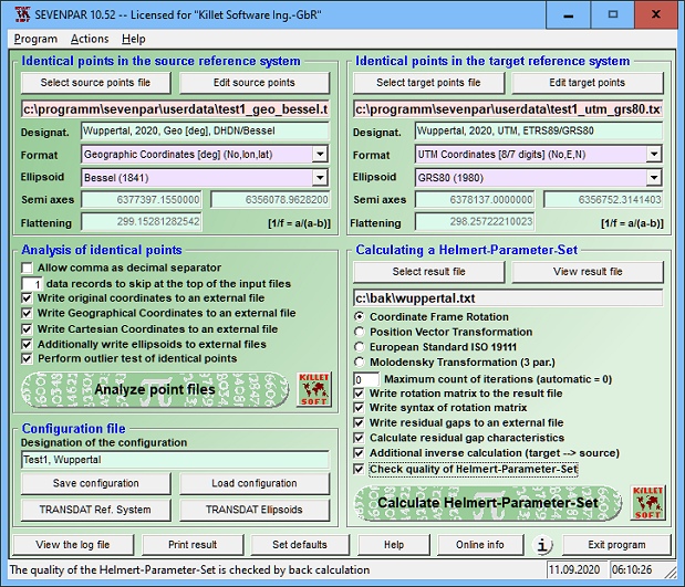
(Click to Enlarge)
SEVENPAR is a tool for the calculation of highly exact transformation parameters for the Spatial Helmert and Molodensky Transformation, which make possible precise coordinate transformations from one reference system into another. The determined transformation parameters can be entered directly into suitable transformation software, e.g. TRANSDAT Coordinate Transformations, or into the calculation software of GPS receivers to do exact coordinate transformations. The seven or three transformation parameters are computed with a set of individual identical points. Those are points with known coordinates in both reference systems (geodetic datum). Cartesian coordinates, geographical coordinates or UTM coordinates with or without ellipsoidal height using the ellipsoid dimensions are suitable. Identical measuring points of higher order can be usually inquired or referred by the official institutions for measurement. The necessary ellipsoid half-axes and flattenings are available in the program for the selection from lists. The coordinates of the identical points are tested intensively on outliers and deviations by different statistic procedures. The quality of the computed parameters is documented by a residual matrix and by the computation of the middle, maximum and root mean square (RMS) deviations. The seven parameters of the Spatial Helmert Transformation are calculated in the three most usual standards Coordinate Frame Rotation, Position Vector Transformation and European Standard ISO 19111. The three parameters for Molodenky parameter sets are calculated using the Standard Molodensky Transformation. The program has user-selectable interfaces in English, Spanish, French, Portugeese and German language and comes with extensive bi-language online help. It can be run on most common networks and it is possible to use Terminal Services on WINDOWS Servers. The client installations are done automatically.
Specifications:
Version: 16.06 |
Download
|

Similar Products:
Development :: Components & Libraries
 dotConnect for Oracle is a versatile, high-performance .NET connector that offers direct access to Oracle Database with no need for Oracle Client. It fully complies with ADO.NET standards, supports advanced ORM with Entity Framework and LinqConnect, and ensures optimal application performance through intelligent fetch and batch processing.
Windows | Shareware
Read More
DOTCONNECT FOR POSTGRESQL 9.1.35
Development :: Components & Libraries
 dotConnect for PostgreSQL is a high-performance ADO.NET data provider that grants simple access to PostgreSQL databases when developing PostgreSQL-based applications.
It fully supports Entity Framework (EF Core), Dapper, and NHibernate, along with a wide range of PostgreSQL-specific features, such as secure SSL connections, PostgreSQL notifications, PostgreSQL bulk data loading, GEOMETRY, PostgreSQL ARRAY types, and others.
dotConnect for PostgreSQL is a high-performance ADO.NET data provider that grants simple access to PostgreSQL databases when developing PostgreSQL-based applications.
It fully supports Entity Framework (EF Core), Dapper, and NHibernate, along with a wide range of PostgreSQL-specific features, such as secure SSL connections, PostgreSQL notifications, PostgreSQL bulk data loading, GEOMETRY, PostgreSQL ARRAY types, and others.
Windows | Shareware
Read More
Development :: Components & Libraries
 dotConnect for MySQL is a high-performance ADO.NET data provider that grants simple access to MySQL and MariaDB databases when developing MySQL-based applications.
It fully supports Entity Framework (EF Core), Dapper, and NHibernate, along with a wide range of MySQL-specific features, such as secure SSL and SSH connections, embedded servers, compression protocol, HTTP tunneling, and others.
dotConnect for MySQL is a high-performance ADO.NET data provider that grants simple access to MySQL and MariaDB databases when developing MySQL-based applications.
It fully supports Entity Framework (EF Core), Dapper, and NHibernate, along with a wide range of MySQL-specific features, such as secure SSL and SSH connections, embedded servers, compression protocol, HTTP tunneling, and others.
Windows | Shareware
Read More
Business :: Math & Scientific Tools
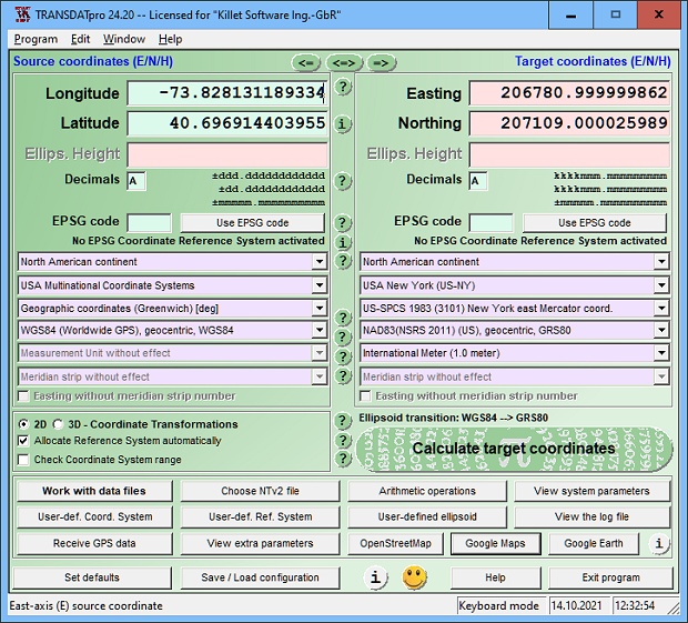 TRANSDATpro Coordinate Transformation supports thousands of coordinate systems and geodetic datum shifts, user-defined systems, INSPIRE, NTv2, NAD, HARN, EPSG, GPS, continental drift, Text, CSV, Arc-Shape, KML, GPX and other file systems with highest accuracy. Outdoor GPS reception, mapping in Google Earth, Google Maps and OpenStreetMap, Meridian Convergence and Extra Parameter, Polygonal scopes in NTv2 files, multilingual user interface.
Windows | Shareware
Read More