


N5 Net Software Repository
Your one-stop for all your software needs.
Search N5 Net Software Repository:
Search Files
Sponsor:
Browse:
- Audio & Multimedia (1527)
- Business (1697)
- Communications (462)
- Desktop (135)
- Development (555)
- Education (163)
- Games & Entertainment (700)
- Graphic Apps (657)
- Home & Hobby (102)
- Network & Internet (524)
- Security & Privacy (499)
- Servers (65)
- System Utilities (8668)
- Web Development (279)
Areas Of Interest
Authors Area
Are you a software author? Take a look at our Author Resource Center where you will find marketing tools, software specifically created for promoting your software and a ton of other helpful resources.
Search: geodetic
Development :: Components & Libraries
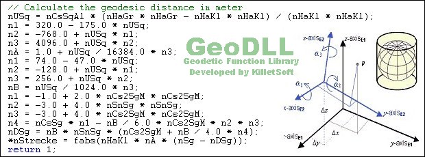 GeoDLL is a Geodetic Development Kit / Geodetic Function Library with worldwide 2D and 3D Coordinate Transformation, Datum Shift, Meridian Convergence and Extra Parameter with highest accuracy. Furthermore: Helmert and Molodensky Parameters, NTv2, HARN, INSPIRE, EPSG, Digital Elevation Model (DEM), distance and Time Zone calculations and much more. GeoDLL for geodetic and GIS development is available as 32Bit and 64Bit DLL and as C++ source code.
Windows | Shareware
Read More | Download Now
Business :: Databases & Tools
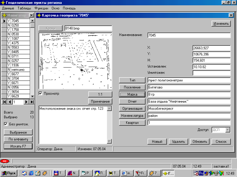 for municipalities and geodetic corporations with the purposes of support of the directory of basic geodetic points placed during operations on geodetic shooting and carry to a nature of the civil-engineering designs on territory of municipality and provides: Support of databases of geodetic points, including the thumbnails of their allocation on district and figures of brands of items; ?reation and printing of cards of items.
Windows | Shareware
Read More | Download Now
Education :: Geography
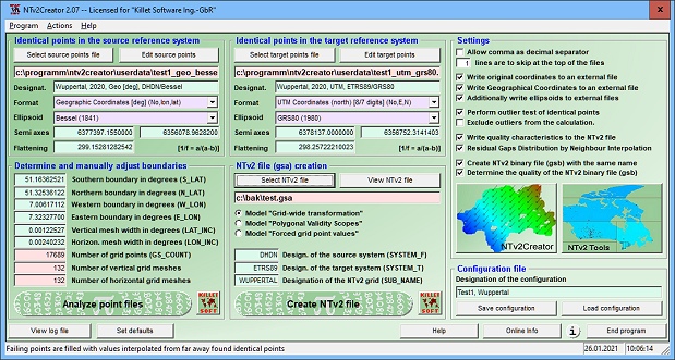 NTv2Creator geosoftware provides a powerful tool for modeling accurate NTv2 files from identical points in two different Reference Systems. The software analyses two files with identical points and suggests the boundaries and mesh sizes which can then be changed manually.
Windows | Shareware
Read More | Download Now
Business :: Math & Scientific Tools
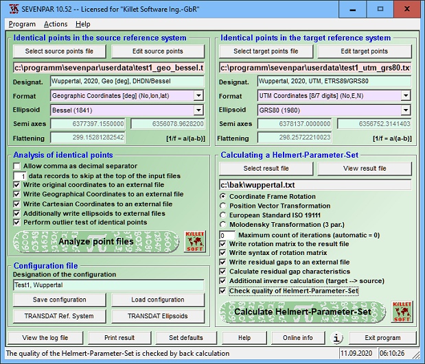 SEVENPAR is a tool for the calculation of highly exact transformation parameters for the Spatial Helmert and Molodensky Transformation, which make possible precise coordinate transformations from one reference system into another. The determined transformation parameters can be entered directly into suitable transformation software, e.g. TRANSDAT Coordinate Transformations, or into the calculation software of GPS receivers.
Windows | Shareware
Read More | Download Now
Business :: Databases & Tools
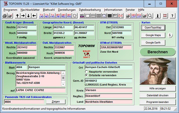 TOPOWIN is a state-wide register of the German topographic cartographies and of localities with geo references in different coordinate systems. It also is a topographic information system. The topographical maps of different standards can be determined by the entering of known parameters or by the direct selection from overview graphics and from sorted lists.
Windows | Shareware
Read More | Download Now
Business :: Math & Scientific Tools
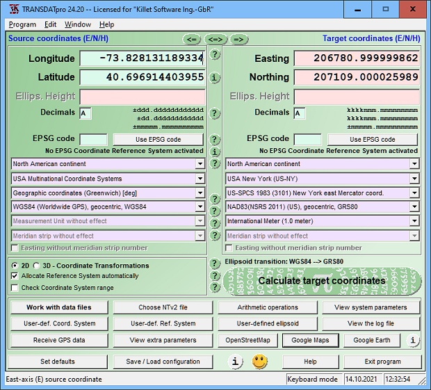 TRANSDATpro Coordinate Transformation supports thousands of coordinate systems and geodetic datum shifts, user-defined systems, INSPIRE, NTv2, NAD, HARN, EPSG, GPS, continental drift, Text, CSV, Arc-Shape, KML, GPX and other file systems with highest accuracy. Outdoor GPS reception, mapping in Google Earth, Google Maps and OpenStreetMap, Meridian Convergence and Extra Parameter, Polygonal scopes in NTv2 files, multilingual user interface.
Windows | Shareware
Read More | Download Now
[1]