


N5 Net Software Repository
Your one-stop for all your software needs.
Search N5 Net Software Repository:
Search Files
Sponsor:
Browse:
- Audio & Multimedia (3039)
- Business (5565)
- Communications (1642)
- Desktop (531)
- Development (1260)
- Education (505)
- Games & Entertainment (1131)
- Graphic Apps (1290)
- Home & Hobby (269)
- Network & Internet (1005)
- Security & Privacy (1246)
- Servers (129)
- System Utilities (32725)
- Web Development (518)
Areas Of Interest
Authors Area
Are you a software author? Take a look at our Author Resource Center where you will find marketing tools, software specifically created for promoting your software and a ton of other helpful resources.
OzGIS 14.7.0.7
Business :: Math & Scientific Tools
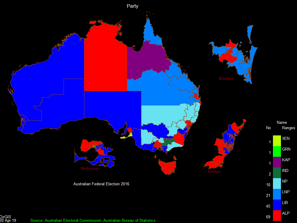
(Click to Enlarge)
OzGIS is an extensive system for the analysis and display of geographically referenced data. About 150 menus provide an enormous range of options for: . importing data from databases, spreadsheets and Geographic Information Systems (GISs) or downloaded from Census Bureaux or mapping agencies. . processing data in preparation for display and analysis . display of data as several different types of maps and diagrams. . facilities to analyse displayed data and to manipulate the maps. . Special support for site catchment analysis, location / allocation and territory assignment. The system can be used to analyze socio-economic and demographic data produced by censuses and surveys and to support management decisions associated with for example marketing, sales, site and personnel location, and advertising. Other spatial data such as environmental data can be displayed. Search for OzGIS on Youtube for tutorial / demonstration videos.
Specifications:
Version: 14.7.0.7 |
Download
|

Similar Products:
Web Development :: HTML Tools
 Easily create HTML image maps with this free friendly image/photo mapping utility from the authors of the best free photo editing software - Photo Pos Pro photo editor. Pos HTML Image Mapper includes WYSIWYG interface allowing you mapping images fast and easy. Using the software you can easily create graphic toolbars to your website; you can easily link desired areas in a pictures & photos to URL's and add it to your website and more.
Windows | Freeware
Read More
System Utilities :: Printer
 Graph Paper Generator generates Cartesian (square), Multilevel Cartesian, and Hexagonal graph paper. It has a WYSIWYG configuration interface with a docking property window that allows fast, interactive specification of the graph paper. Cell sizes are specified in milimeters, and line thicknesses are specified in printer pixels. You can customise line color, thickness, style (dash, dot, solid, etc). You can set a background color for the page.
Windows | Shareware
Read More
DEKSI NETWORK MONITORING SUITE 7.5
Network & Internet :: Network Monitoring
 DEKSI Network Monitoring Suite is a set of three award winning network software tools for network mapping, network monitoring, and bandwidth monitoring. Windows 9X, NT, 2000, XP, 2003 Server, 2008 Server, 2012 Server, VISTA, and Windows 7, 8, 8.1, and 10 compatible.
Windows | Shareware
Read More
System Utilities :: Other
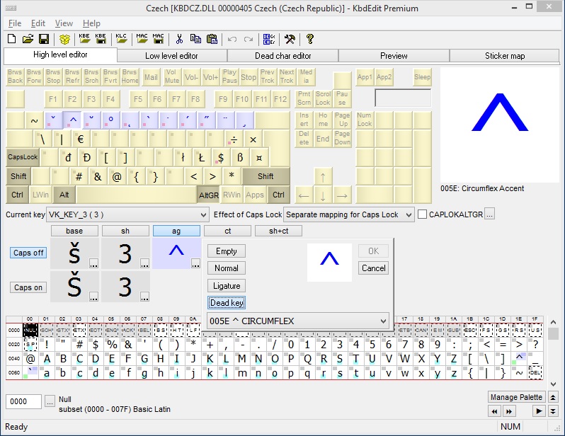 Assign any Unicode character to, or change function of any standard or special key. Multiple level Undo/Redo. Instant Preview screen for testing. Comfortable Unicode navigation. Drag&drop inside KbdEdit and from/to other applications. Advanced techniques: Ligatures, dead keys, togglable KANA modifier. Can import KLC files produced by MSKLC. Custom layouts automatically added to Language Bar list. Deployment through export/import in own KBE format
Windows | Shareware
Read More