Search N5 Net Software Repository:
Search Files
Sponsor:
Browse:
- Audio & Multimedia (1596)
- Business (4238)
- Communications (1258)
- Desktop (183)
- Development (602)
- Education (171)
- Games & Entertainment (702)
- Graphic Apps (686)
- Home & Hobby (107)
- Network & Internet (571)
- Security & Privacy (532)
- Servers (65)
- System Utilities (11196)
- Web Development (284)
Areas Of Interest
Authors Area
Are you a software author? Take a look at our Author Resource Center where you will find marketing tools, software specifically created for promoting your software and a ton of other helpful resources.
Search: coordinate
::
 Calc3D is a calculator for 3-dimensional vectors, matrices, complex numbers, quaternions.
For objects ( like point, line, plane and sphere) distances, intersections, volume, area of squeres, area of a triangle can be calculated.
Cartesian coordinates, spherical coordinates und cylindrical coordinates can be transformed into each other.
(5 languages)
Windows | Shareware
Read More | Download Now
::
Cartesian coordinates, spherical coordinates und cylindrical coordinates can be transformed into each other.
(5 languages, 2 and 3 dimensions)
Windows | Shareware
Read More | Download Now
Business :: Databases & Tools
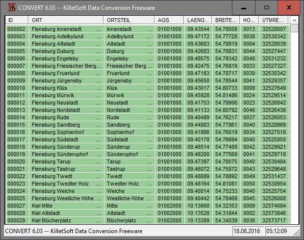 The database contain geodata of the Federal Republic of Germany with geo referenced towns, municipalities, town quarters, administrative units, postal codes, telephone preselections, nature areas, landscapes, climatic zones. The data contain coordinates for navigation and geo-coding, proximity searches, distance computations and for mapping of landscape information. It is possible to assign a variety of nature and scenic information to each town.
Windows | Data Only
Read More | Download Now
Development :: Components & Libraries
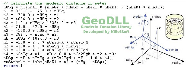 GeoDLL is a Geodetic Development Kit / Geodetic Function Library with worldwide 2D and 3D Coordinate Transformation, Datum Shift, Meridian Convergence and Extra Parameter with highest accuracy. Furthermore: Helmert and Molodensky Parameters, NTv2, HARN, INSPIRE, EPSG, Digital Elevation Model (DEM), distance and Time Zone calculations and much more. GeoDLL for geodetic and GIS development is available as 32Bit and 64Bit DLL and as C++ source code.
Windows | Shareware
Read More | Download Now
System Utilities :: Printer
 Graph Paper Generator generates Cartesian (square), Multilevel Cartesian, and Hexagonal graph paper. It has a WYSIWYG configuration interface with a docking property window that allows fast, interactive specification of the graph paper. Cell sizes are specified in milimeters, and line thicknesses are specified in printer pixels. You can customise line color, thickness, style (dash, dot, solid, etc). You can set a background color for the page.
Windows | Shareware
Read More | Download Now
INNERSOFT CAD FOR AUTOCAD 2005 2.2A
Graphic Apps :: CAD
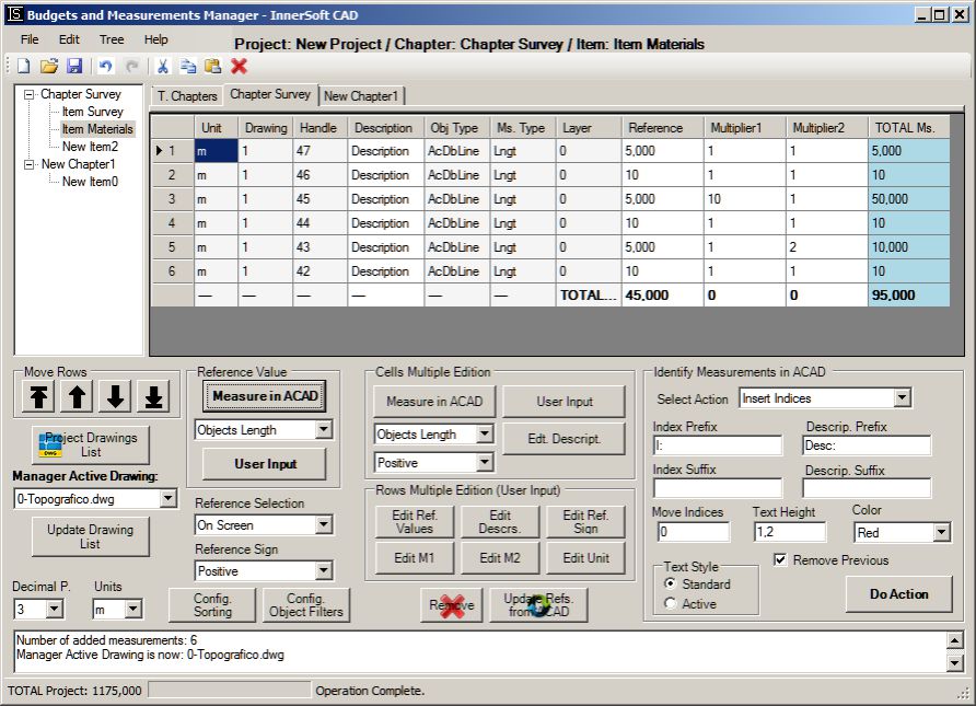 InnerSoft CAD is a add-on for AutoCAD. This group of tools will allows you to: Export to a Excel Sheet the values of Area/Length property or coordinates for various AutoCAD entities. Import from a Excel Sheet the vertex coordinates for a set of 2D polylines or 3D polylines (you can choose between 3 different methods). You can also make measurements on AutoCAD for project budgets and open or save different libraries AutoCAD drawing libraries.
Windows | Demo
Read More | Download Now
Education :: Geography
 Latitude and Longitude app for android allows you to get or share map coordinates of your current location. You can share gps coordinates in many ways using Latitude Longitude app. - share your current gps location with anyone using GPS coordinates, address or both. - share a location of some point on the map coordinate. Let's say if you want to meet someone, you can send him the location as GPS coordinates, address or both.
| Freeware
Read More | Download Now
Business :: Databases & Tools
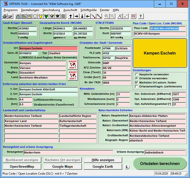 ORTWIN is a program for the inquiry of localities, postal codes and telephone selections in Germany. It finds coordinates and ground level elevations, municipal codes, local center points, car license codes, topographic maps, Unlocodes and much more. It arranges localities hierarchically in different administrative units. It performs perimeter searches and distance calculations. It finds landscapes, natural units and snow- and wind load zones.
Windows | Shareware
Read More | Download Now
Business :: Math & Scientific Tools
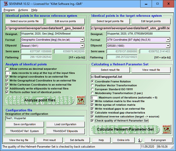 SEVENPAR is a tool for the calculation of highly exact transformation parameters for the Spatial Helmert and Molodensky Transformation, which make possible precise coordinate transformations from one reference system into another. The determined transformation parameters can be entered directly into suitable transformation software, e.g. TRANSDAT Coordinate Transformations, or into the calculation software of GPS receivers.
Windows | Shareware
Read More | Download Now
Business :: Databases & Tools
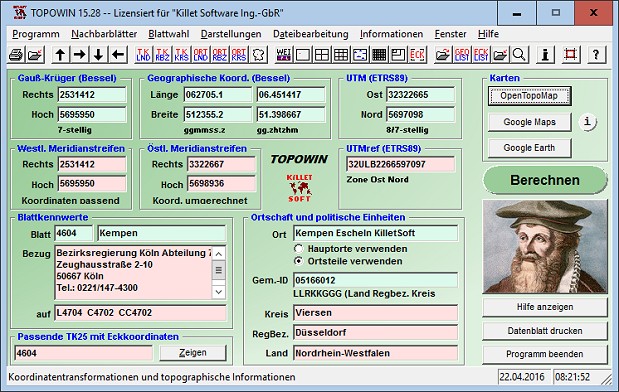 TOPOWIN is a state-wide register of the German topographic cartographies and of localities with geo references in different coordinate systems. It also is a topographic information system. The topographical maps of different standards can be determined by the entering of known parameters or by the direct selection from overview graphics and from sorted lists.
Windows | Shareware
Read More | Download Now
Business :: Math & Scientific Tools
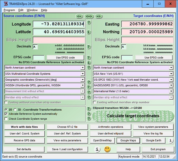 TRANSDATpro Coordinate Transformation supports thousands of coordinate systems and geodetic datum shifts, user-defined systems, INSPIRE, NTv2, NAD, HARN, EPSG, GPS, continental drift, Text, CSV, Arc-Shape, KML, GPX and other file systems with highest accuracy. Outdoor GPS reception, mapping in Google Earth, Google Maps and OpenStreetMap, Meridian Convergence and Extra Parameter, Polygonal scopes in NTv2 files, multilingual user interface.
Windows | Shareware
Read More | Download Now
[1]


