


N5 Net Software Repository
Your one-stop for all your software needs.
Search N5 Net Software Repository:
Search Files
Sponsor:
Browse:
- Audio & Multimedia (1527)
- Business (1697)
- Communications (462)
- Desktop (135)
- Development (555)
- Education (163)
- Games & Entertainment (700)
- Graphic Apps (657)
- Home & Hobby (102)
- Network & Internet (524)
- Security & Privacy (499)
- Servers (65)
- System Utilities (8668)
- Web Development (279)
Areas Of Interest
Authors Area
Are you a software author? Take a look at our Author Resource Center where you will find marketing tools, software specifically created for promoting your software and a ton of other helpful resources.
Downloading GoogleEarthTweaker 1.08
Your download will begin in a few seconds. If it does not start you can download directly through one of the mirror sites below.
- Mirror Site 1: http://www.itsth.de/download/GoogleEarthTweaker.exe
- Mirror Site 2: http://www.itsth.de/download/GoogleEarthTweaker.exe
- Mirror Site 3: http://www.itsth.de/download/GoogleEarthTweaker.exe
- Mirror Site 4: http://www.itsth.de/download/GoogleEarthTweaker.exe
Get Details for GoogleEarthTweaker 1.08
Similar Products:
GOOGLE EARTH IMAGES DOWNLOADER 6.49
Network & Internet :: Download Managers
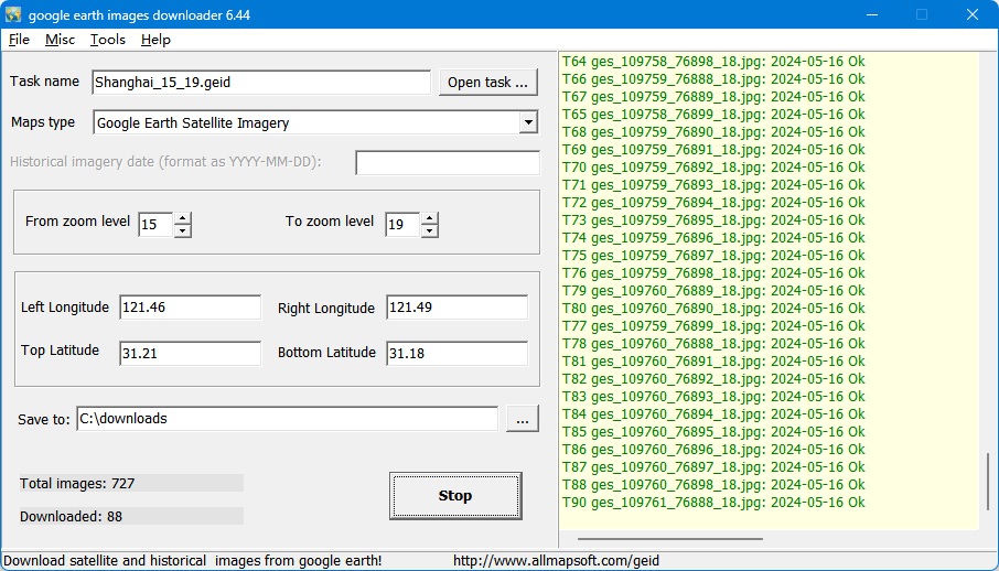 google earth images downloader is a tool that help you to get offline satellite tile images from google earth (not google maps), including historical imagery. It can work without google earth installed.
Windows | Shareware
Read More
Home & Hobby :: Genealogy
 Now you can link the individuals in your family tree to the powerful mapping capabilities of Google Earth. Automatically create Placemarks for events in the lives of individuals and view a path following the movements during their lifetime. Use the timespan slider feature of Google Earth to restrict the view to a period of history and watch your family's story unfold...
Windows | Shareware
Read More
Graphic Apps :: Editors
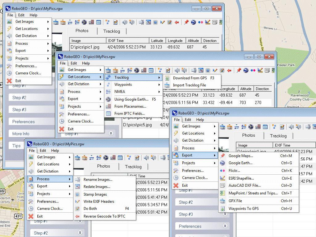 Geocode digital photos, including RAW. Stamp the images or write (lossless) to the EXIF. Create web pages using Google Maps, export KML/KMZ files to Google Earth, upload to Flickr, export shapefiles (SHP), GPX, or AutoCAD DXF files. Supports Garmin GPS units (USB or COM), but no GPS is required. Geotag from a tracklog, waypoints, NMEA, placenames or a GPX file. UTM and MGRS support. Easy to use. Free lifetime upgrades.
Windows | Demo
Read More
Graphic Apps :: Other
 GEPlot is a Windows application for plotting contour lines (also known as isolines, isopleths or isarithms) and grids in KMZ or KML (Keyhole Markup Language) format for Google Earth. The input data can be ASCII (X, Y, Z format or Surfer GRD format) or Microsoft Excel as X, Y, Z columns.
GEPlot allows to produce grid and contour plots for any georeferenced variable, such as, for example, orography or land cover.
GEPlot is a Windows application for plotting contour lines (also known as isolines, isopleths or isarithms) and grids in KMZ or KML (Keyhole Markup Language) format for Google Earth. The input data can be ASCII (X, Y, Z format or Surfer GRD format) or Microsoft Excel as X, Y, Z columns.
GEPlot allows to produce grid and contour plots for any georeferenced variable, such as, for example, orography or land cover.
Windows | Commercial
Read More