


N5 Net Software Repository
Your one-stop for all your software needs.
Search N5 Net Software Repository:
Search Files
Sponsor:
Browse:
- Audio & Multimedia (3039)
- Business (5565)
- Communications (1642)
- Desktop (531)
- Development (1260)
- Education (505)
- Games & Entertainment (1131)
- Graphic Apps (1290)
- Home & Hobby (269)
- Network & Internet (1005)
- Security & Privacy (1246)
- Servers (129)
- System Utilities (32725)
- Web Development (518)
Areas Of Interest
Authors Area
Are you a software author? Take a look at our Author Resource Center where you will find marketing tools, software specifically created for promoting your software and a ton of other helpful resources.
Search: soil office software group
BORING LOG & SOIL TESTING SOFTWARE 4.0
Business :: Math & Scientific Tools
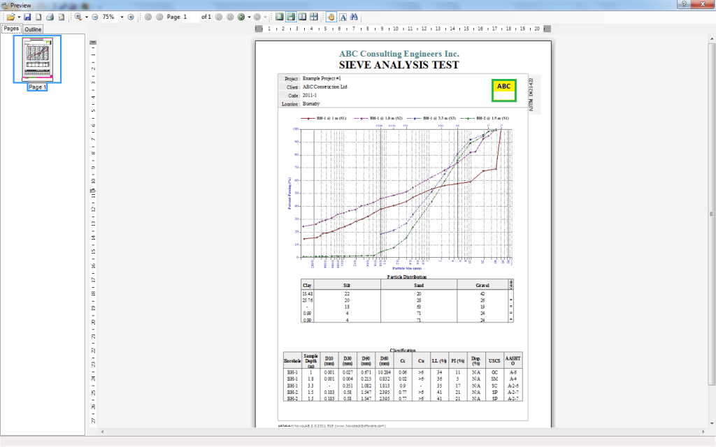 NovoLAB is designed for geotechnical lab test processing and borehole log drafting. It covers various drilling methods, sample types and several other features. Lab. Tests: Sieve Analysis (gradation) Test and Soil Classification (USCS, AASHTO), Atterberg Limits Test, Moisture and Density Test / Field Density Test, Direct Shear Test, Triaxial Compression Test, Unconfined Compression Test, Permeability Test, Consolidation Test
Windows | Shareware
Read More | Download Now
SOIL LIQUEFACTION SOFTWARE NOVOLIQ 4.0
Business :: Math & Scientific Tools
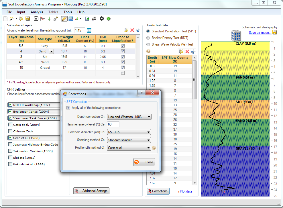 NovoLIQ conducts soil liquefaction analysis based on Standard Penetration Test (SPT), Becker Penetration Test (BPT), Shear Wave Velocity (Vs). Other features include Unlimited soil layers, Applying corrections on field test (overburden, etc), 10 liquefaction analysis methods, Probability of liquefaction (Youd and Noble), Post-liquefaction site displacements and Sr, Magnitude scaling factor (8 options), Fines content correction.
Windows | Shareware
Read More | Download Now
SOIL PROFILE VISUALIZATION SOFTWARE - VISLOG 4.0
Business :: Math & Scientific Tools
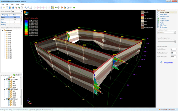 Using VisLog, the user will be able to enter borehole information make a 3-dimensional interactive view of the subsurface layers. Input data can be entered manually or imported directly from gINT. The 3D model can then be exported to PDF, image formats and movie format which are easily viewable by the clients and can be attached to geotechnical reports.
Windows | Shareware
Read More | Download Now
SOIL PROFILE VISUALIZATION SOFTWARE - VISLOG 3.0
Education :: Science
 Using VisLog, the user will be able to enter borehole information make a 3-dimensional interactive view of the subsurface layers. Input data can be entered manually or imported directly from gINT. The 3D model can then be exported to PDF, image formats and movie format which are easily viewable by the clients and can be attached to geotechnical reports.
Windows | Shareware
Read More | Download Now