


N5 Net Software Repository
Your one-stop for all your software needs.
Search N5 Net Software Repository:
Search Files
Sponsor:
Browse:
- Audio & Multimedia (1527)
- Business (1697)
- Communications (462)
- Desktop (135)
- Development (555)
- Education (163)
- Games & Entertainment (700)
- Graphic Apps (657)
- Home & Hobby (102)
- Network & Internet (524)
- Security & Privacy (499)
- Servers (65)
- System Utilities (8668)
- Web Development (279)
Areas Of Interest
Authors Area
Are you a software author? Take a look at our Author Resource Center where you will find marketing tools, software specifically created for promoting your software and a ton of other helpful resources.
Search: measuring
Business :: Math & Scientific Tools
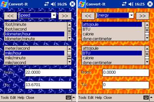 Cresotech Convert-It gives you the option to use a single tool to convert almost anything into anything. It is always at your disposal - just reach your Pocket PC, run Convert-It and change all strange and unfamiliar measuring system units into something you used to. Do not refer to thick folios; do not spent your time and money searching for answers over the web - get all what you need in one touch and split seconds from your Pocket PC!
Windows | Shareware
Read More | Download Now
Business :: Databases & Tools
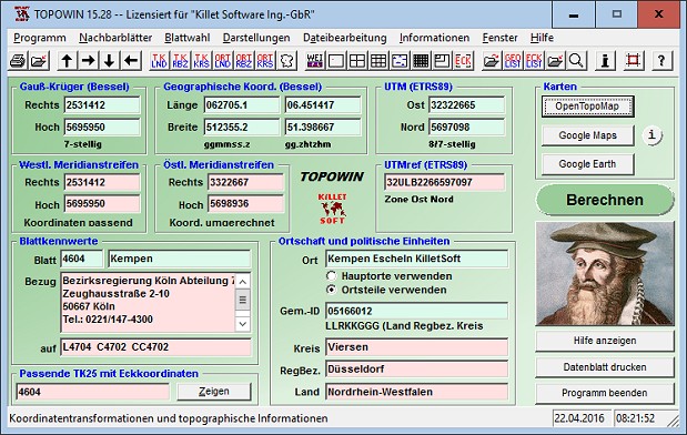 TOPOWIN is a state-wide register of the German topographic cartographies and of localities with geo references in different coordinate systems. It also is a topographic information system. The topographical maps of different standards can be determined by the entering of known parameters or by the direct selection from overview graphics and from sorted lists.
Windows | Shareware
Read More | Download Now