Search N5 Net Software Repository:
Search Files
Sponsor:
Browse:
- Audio & Multimedia (1596)
- Business (4238)
- Communications (1257)
- Desktop (183)
- Development (602)
- Education (171)
- Games & Entertainment (702)
- Graphic Apps (686)
- Home & Hobby (107)
- Network & Internet (571)
- Security & Privacy (532)
- Servers (65)
- System Utilities (11196)
- Web Development (284)
Areas Of Interest
Authors Area
Are you a software author? Take a look at our Author Resource Center where you will find marketing tools, software specifically created for promoting your software and a ton of other helpful resources.
Search: maps
VERYUTILS DIAGRAM EDITOR SOFTWARE 2.7
Business :: Office Suites & Tools
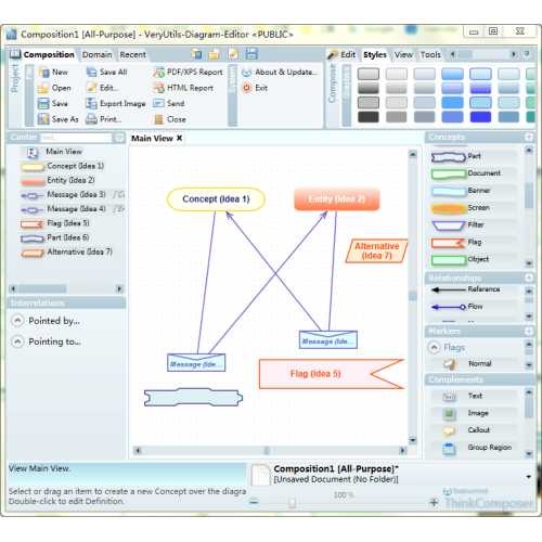
 VeryUtils Diagram Editor is an extremely powerful all-in-one diagramming tool that can serve all of your purposes. Whether you need to draw flowcharts, fishbone diagrams, UML diagrams or design floor plans, office layouts, you can find what you want in Diagram Editor software. Importantly, it is quite affordable. With VeryUtils Diagram Editor software, you can apply the power of comprehensive visual documents to get the job done and work better.
Windows | Shareware
Read More | Download Now
Development :: Active X
 WeOnlyDo! COM ImapServer ActiveX control is component that can be easily integrated into your applications to provide full IMAP4rev1 protocol server implementation. All you need to do is to put it on VB form, call it's Start method and it's immediately accepting connections by your clients! It fully supports commands defined in RFC2060.
Windows | Shareware
Read More | Download Now
WORLD AND USA MAP LOCATOR FIX 1.4
Web Development :: Flash Tools
 Golden World and USA Map Locator. Features: Driven by XML interface; - Color, URL linking, captions and more. And you can do all these; - Intuitive Flash Map Interface; - Ease of Use; - Customizations via an XML file, no Flash source modifications required; - Any settings can be done using external XML file; www.fla-shop.com Suitable for Real-Estate, Dealer Maps, Branch Offices Locators
Windows MAC | Demo
Read More | Download Now
Network & Internet :: Download Managers
 Yandex Maps Downloader is a tool that can automatically download the Yandex maps images to your PC. It can download the small tiles and save them to your hard disk, including the normal maps, satellite maps. After downloading, you can view the maps offline by its tool Maps Viewer, or you can combine the small images into one big map image. If you want to make a map of your city by yourself, it is very useful for you.
Windows | Shareware
Read More | Download Now
Web Development :: Flash Tools
Flash maps US States. Features:- Driven by XML interface; - Color, URL linking, captions and more. And you can do all these; - Intuitive Flash Map Interface; - Customizable Hotspots and Tooltips; - Ease of Use; - Customizations via an XML file, no Flash source modifications required; - Any settings can be done using external XML file; - Zoom and Pan tools;
Windows MAC Linux | Demo
Read More | Download Now


