


N5 Net Software Repository
Your one-stop for all your software needs.
Search N5 Net Software Repository:
Search Files
Sponsor:
Browse:
- Audio & Multimedia (1527)
- Business (1697)
- Communications (462)
- Desktop (135)
- Development (555)
- Education (163)
- Games & Entertainment (700)
- Graphic Apps (657)
- Home & Hobby (102)
- Network & Internet (524)
- Security & Privacy (499)
- Servers (65)
- System Utilities (8668)
- Web Development (279)
Areas Of Interest
Authors Area
Are you a software author? Take a look at our Author Resource Center where you will find marketing tools, software specifically created for promoting your software and a ton of other helpful resources.
Search: g lock software
Communications :: E-Mail Clients
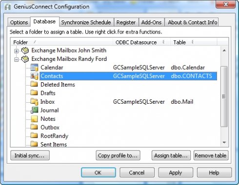 GeniusConnect will synchronize mail folders with any relational database that supports ODBC (MS Access, mySQL, MS SQL Server, Oracle etc.). You can use your own table structure and define conversions for columns with data type's that are not compatible with an Outlook field.
Windows | Shareware
Read More | Download Now
GENIUS CONNECT-EMAIL MARKETING 6.0.1.0
Communications :: E-Mail List Management
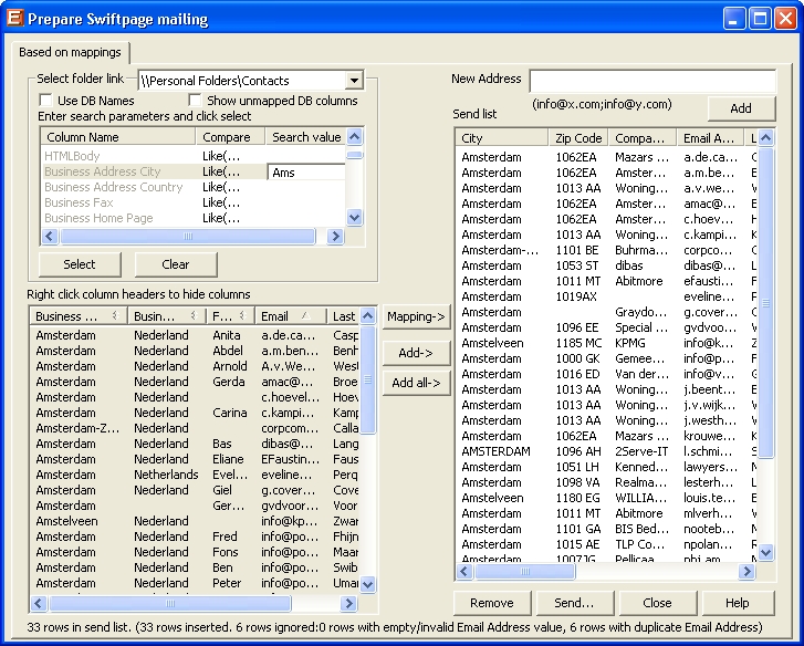 Send email marketing campaigns directly from GeniusConnnect using Swiftpage Add-on for GeniusConnect. GeniusConnect allows you to put together criteria for targeted mailings by using GeniusConnect's filter capabilities. The delivery, tracking and statistics will then be handled by Swiftpage?s solution.
Windows | Shareware
Read More | Download Now
::
 Genkisoft TurboHex is an extremely fast and lightweight hex editor for Windows that combines raw power with and extremely easy to use interface. View and edit physical and logical disks and partitions, and edit raw file data, including NTFS file streams. Works on CDs, ZIP disks, SmartMedia, and more.
Windows | Shareware
Read More | Download Now
Graphic Apps :: Editors
 GentleDraw is a program for creation of 3D models from black-and-white images using vector conversion. You can move and rotate 3D models just by dragging them, changes are shown on the screen in real time. You can easily adjust color, texture, borders and animation settings. GentleDraw can save animations as animated GIF files. The program includes 3D models borders editor and animation routes trace editor.
Windows | Shareware
Read More | Download Now
Education :: Languages
 Electronic thesaurus of related place names. Groups together related place names. Describes location for countries. English, German, French and Italian.
Windows | Shareware
Read More | Download Now
Business :: Databases & Tools
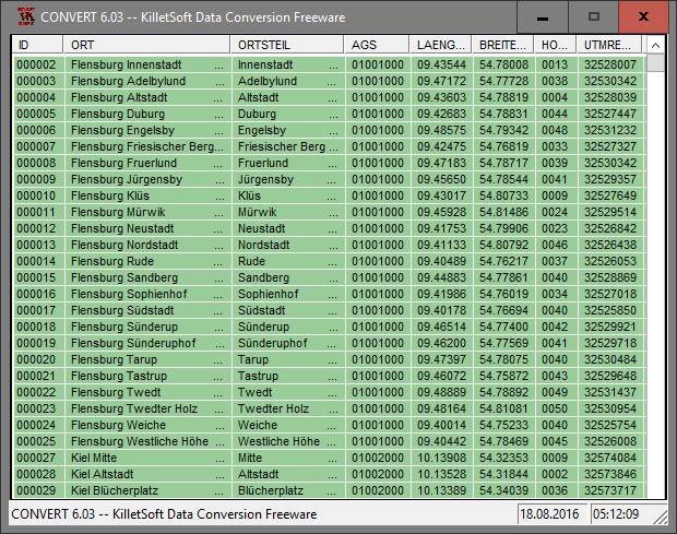 The database contain geodata of the Federal Republic of Germany with geo referenced towns, municipalities, town quarters, administrative units, postal codes, telephone preselections, nature areas, landscapes, climatic zones. The data contain coordinates for navigation and geo-coding, proximity searches, distance computations and for mapping of landscape information. It is possible to assign a variety of nature and scenic information to each town.
Windows | Data Only
Read More | Download Now
Development :: Components & Libraries
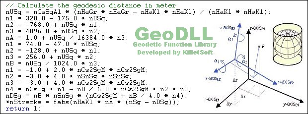 GeoDLL is a Geodetic Development Kit / Geodetic Function Library with worldwide 2D and 3D Coordinate Transformation, Datum Shift, Meridian Convergence and Extra Parameter with highest accuracy. Furthermore: Helmert and Molodensky Parameters, NTv2, HARN, INSPIRE, EPSG, Digital Elevation Model (DEM), distance and Time Zone calculations and much more. GeoDLL for geodetic and GIS development is available as 32Bit and 64Bit DLL and as C++ source code.
Windows | Shareware
Read More | Download Now
Business :: Databases & Tools
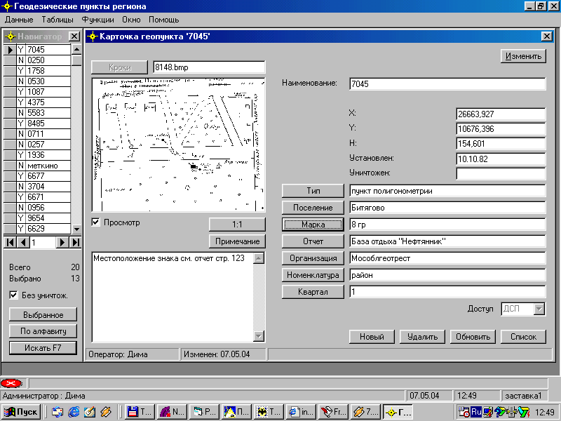 for municipalities and geodetic corporations with the purposes of support of the directory of basic geodetic points placed during operations on geodetic shooting and carry to a nature of the civil-engineering designs on territory of municipality and provides: Support of databases of geodetic points, including the thumbnails of their allocation on district and figures of brands of items; ?reation and printing of cards of items.
Windows | Shareware
Read More | Download Now
GEOTECHNICAL CORRELATIONS NOVOFORMULA 2.0
Business :: Math & Scientific Tools
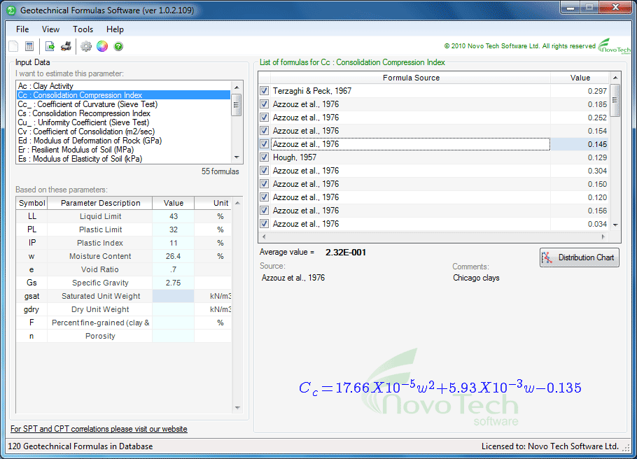 Geotechnical engineers can use this software for day-to-day analysis and calculations. NovoFORMULA is used for estimation of soil properties based on other soil properties (example: consolidation Cc from moisture content).
Windows | Shareware
Read More | Download Now
GEOTECHNICAL CORRELATIONS SOFTWARE - NOVOFORMULA 1.0
Education :: Science
Geotechnical engineers can use this software for day-to-day analysis and calculations. NovoFORMULA is used for estimation of soil properties based on other soil properties (example: consolidation Cc from moisture content).
Windows | Shareware
Read More | Download Now
Business :: Vertical Market Apps
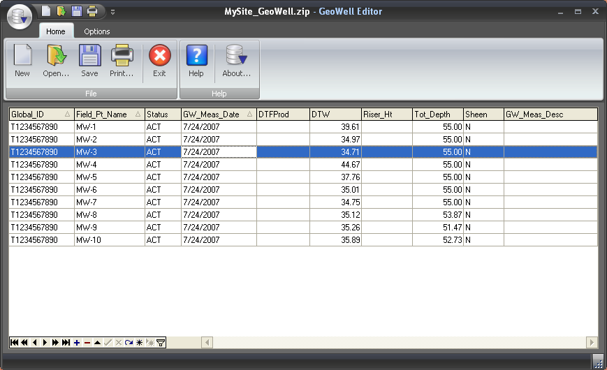 The GeoWell Editor? is a stand-alone editor that simplifies the production of GEO_WELL data files for submission to California's GeoTracker system. GeoWell Editor? handles the tedious aspects of formatting data files and of providing data entry validation. It does this by providing data entry validation and eliminating the need for you to manually export data to the specific format required by the GeoTracker system.
Windows | Shareware
Read More | Download Now