


N5 Net Software Repository
Your one-stop for all your software needs.
Search N5 Net Software Repository:
Search Files
Sponsor:
Browse:
- Audio & Multimedia (3039)
- Business (5565)
- Communications (1642)
- Desktop (531)
- Development (1260)
- Education (505)
- Games & Entertainment (1131)
- Graphic Apps (1290)
- Home & Hobby (269)
- Network & Internet (1005)
- Security & Privacy (1246)
- Servers (129)
- System Utilities (32725)
- Web Development (518)
Areas Of Interest
Authors Area
Are you a software author? Take a look at our Author Resource Center where you will find marketing tools, software specifically created for promoting your software and a ton of other helpful resources.
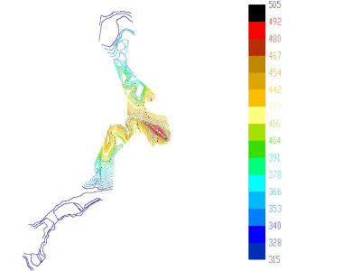
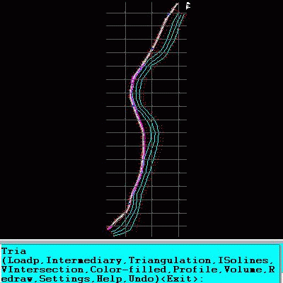
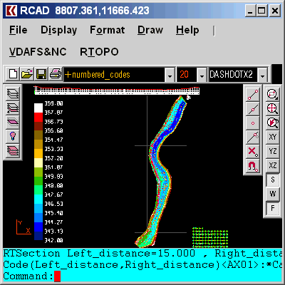
TRIANGULATION for IntelliCAD 3.9d
Graphic Apps :: CAD
(Click to Enlarge)
TRIANGULATION, ISOLINES, VOLUME, LOADING of XYZ points files, 3DINTERSECTION, cross sections and a longitudinal profile, color-filled contour map; 7 functions for IntelliCAD versions which can load SDS applications (dll). TRIANGULATION performs the triangulation of a set of 3D points with compulsory interconnections between the points. The outcome is represented by 3DFACE entities. ISOLINES determines the curves of intersection of a set of 3DFACE entities with a set of equidistance planes, horizontally or vertically. The outcome is made up of POLYLINE entities optionally interpolated. VOLUME determines volume and center of gravity of a body limited by 3DMESH and 3DFACE entities. You can load and draw a file of points having the format: Number X Y Z Code. 3DINTERSECTION determines the intersection curves between 2 sets consisting of 3DFACE and 3DMESH entities. The outcome is represented by 3DPOLY entities. You can make the projection over a triangulation of a 2D POLYLINE and generate cross sections and a longitudinal profile corresponding at projection. The POLYLINE may contain arcs. You can also make color-filled contour map. The price is for the first license! You can buy anytime after, other licenses at a lower price!
Specifications:
Version: 3.9d |
Download
|

Similar Products:
Graphic Apps :: CAD
 An add-on for AUTOCAD or BricsCAD, for the triangulation of a set of POINTS, isolines, DWG to Google Earth, the volume and center of gravity of a set of bodies or between surfaces composed of 3DFACE. You can load a file of points having the format: Number X Y Z Code. You can make cross sections, longitudinal profile and color-filled contour map. You can determine the flatness of the surfaces and you can import and export LandXML file type!
Windows | Shareware
Read More
Graphic Apps :: CAD
 The most convenient program for: loading and drawing XYZ files of points, triangulation, contour lines and color-filled contour maps. You can also draw 4D points cloud and process hundreds of thousands of points or triangles, even on less powerful PCs. You don't need another CAD system. RTOPO LT has its own CAD system. RTOPO LT is the reduced version of the full RTOPO Hydrology CAD for topography.
Windows | Shareware
Read More