Search N5 Net Software Repository:
Search Files
Sponsor:
Browse:
- Audio & Multimedia (1596)
- Business (4238)
- Communications (1257)
- Desktop (183)
- Development (602)
- Education (171)
- Games & Entertainment (702)
- Graphic Apps (686)
- Home & Hobby (107)
- Network & Internet (571)
- Security & Privacy (532)
- Servers (65)
- System Utilities (11196)
- Web Development (284)
Areas Of Interest
Authors Area
Are you a software author? Take a look at our Author Resource Center where you will find marketing tools, software specifically created for promoting your software and a ton of other helpful resources.
RTOPO LT 3.3
Graphic Apps :: CAD
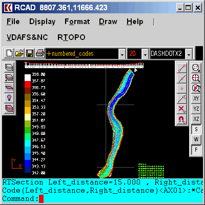
The most convenient program for: loading and drawing XYZ files of points, triangulation, contour lines and color-filled contour maps. You can also draw 4D points cloud and process hundreds of thousands of points or triangles, even on less powerful PCs. You don't need another CAD system. RTOPO LT has its own CAD system. ---- RTOPO LT is the reduced version of the full RTOPO Hydrology CAD for topography, which has in addition: editing of XYZ files of points, cross-sections and longitudinal profile, simulation of rainwater runoff, projection of a curve on triangulation, calculation of the volume between surfaces formed by 3DFACE and the intersection and division of 2 sets of 3DFACE.
Specifications:
Version: 3.3 |
Download
|
Similar Products:
AUTOLISP SOURCE CODE FOR PROGRAMMERS 1.5
Graphic Apps :: CAD
 AutoLISP source code can be run on AutoCAD or IntelliCAD (Bricscad, ProgeCAD, Cadopia, etc.), on any number of computers. There are programs for: Triangulation, Load XYZ and 4D files, B-spline control polygon and interpolated contour lines, Intersect 2 3DFACE and contour lines, Modify longitudinal profile, converts a DWG file to an XYZ file of points and custom "Hatch styles from a DWG". There are shareware versions. The price is per program.
Windows | Data Only
Read More
Graphic Apps :: CAD
 Simple, powerful and inexpensive CAD software for surveying. You can do triangulation, isolines, color-filled contour maps, sections, intersections, volume, editing XYZ files, simulation of rainwater runoff and much more. You can represent 4D points cloud and process hundreds of thousands of points or triangles, even on less powerful PCs.
Windows | Data Only
Read More


